Sigue las últimas publicaciones de ModlEarth blog
Seguir leyendo...
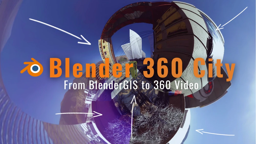
Blender 360 City - De BlenderGIS a Video 360
Seguir leyendo...
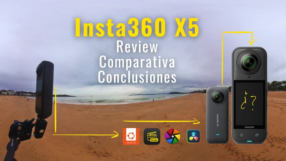
Insta360 X5 - Review y cambios respecto a la X3
Seguir leyendo...
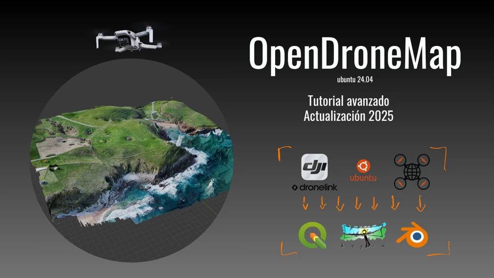
Productos de dron en Linux - OpenDroneMap - Tutorial avanzado
Seguir leyendo...
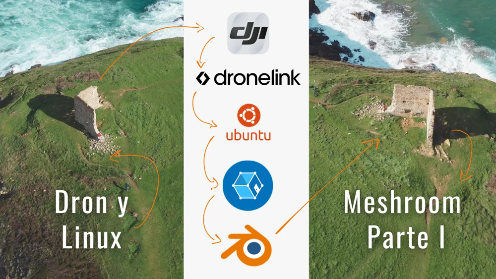
Fotogrametría y Cartografía en Linux - Meshroom y los modelos 3D Mesh
Seguir leyendo...
Make + ChatGPT: La automatización de cualquier cosa
Seguir leyendo...
¿GPX Móvil o Pulsera? Un paseo, dos registros, random forest y R
Seguir leyendo...
Ubuntu 24.04 works: QGIS, Davinci, OpenDroneMap, Blender y más
Seguir leyendo...
DJI Osmo Pocket 2 vs Sony RX100VA vs Insta360X3 vs Xiaomi Note 10
Seguir leyendo...
Conversor de archivos de imagen y vídeo gratis en Linux y Windows
Seguir leyendo...
Insta360 Studio Works...en linux

Seguir leyendo...
Paisaje y Energía en Blender - Los tutoriales completos
Seguir leyendo...
VMware y Shiny Server: Mini PC Ubuntu Server para casa
ModlEarth Blog - R-Shiny, QGIS, Blender & Data Science Tools
ModlEarth Blog - R-Shiny, QGIS, Blender & Data Science Tools
Blender 360 City - De BlenderGIS a Video 360
La creación de entornos digitales tridimensionales exige una combinación de herramientas y técnicas. Nada nuevo hasta aquí. Esta entrada del blog sirve para explorar un flujo de trabajo que integra Blender para el modelado y renderizado, y DaVinci Resolve para la composición y postproducción, con un enfoque particular en el renderizado de vídeo 360 y la optimización del proceso. Este desarrollo se basa en los conocimientos adquiridos en el curso “Master Urban Environments in Blender” (una ganga disponible en CGBOOST), el cual recomiendo para profundizar en estas habilidades. Si consideras realizarlo, puedes usar este enlace para acceder y otorgarme una pequeña comisión sin hacer nada más por tu parte: https://academy.cgboost.com/p/master-urban-environments-in-blender?affcode=206256_8-bmu50q.
Insta360 X5 - Review y cambios respecto a la X3
Me acabo de hacer con la Insta360 X5 no tanto por el hype, que como podéis ver en youtube y diversas redes, es muy alto, si no porque seguía anclado a la X3 y en algunos aspectos sentía que me estaba quedando atrás. La comparativa completa con la Insta360 X3 puede verse en el vídeo, por lo que no profundizaré en ello aquí. Lo que pretendo en este post es mostrar en detalle aspectos de la X5 que pueden servir para mejorar la calidad del trabajo paisajístico profesional.
Productos de dron en Linux - OpenDroneMap - Tutorial avanzado
En este post volveremos a revisar de forma actualizada y más profesional la instalación, configuración y ejecución del programa Open Drone Map. Este programa, ejecutable totalmente desde terminal permite transformar cualquier secuencia ordenada de fotos y vídeos en un mesh (objeto 3D) o en una ortofoto.
Fotogrametría y Cartografía en Linux - Meshroom y los modelos 3D Mesh
En este post volveremos a revisar de forma actualizada y más profesional la instalación, configuración y ejecución del programa Meshroom. Este programa permite reconstruir un modelo tridimensional de la forma más sencilla posible.
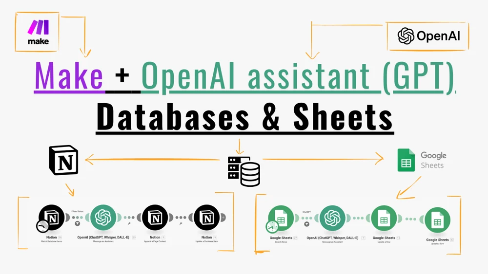
Make + ChatGPT: La automatización de cualquier cosa
En este post encontrarás explicado de forma práctica dos casos de uso en los que puedes combinar el asistente de ChatGPT con Make para automatizar tareas. El primero de ellos va sobre cómo generar título y descripción para vídeos de YouTube en distintos idiomas. Esto lo he hecho principalmente para la serie de mini tutoriales en formato short de YouTube en los que desgrano en forma de tips todo lo expuesto en el curso de Blender para Paisaje y Energía. El segundo ejemplo sirve para automatizar el título, descripción y keywords de una serie de vídeos y fotografías para stock. So, let’s go.
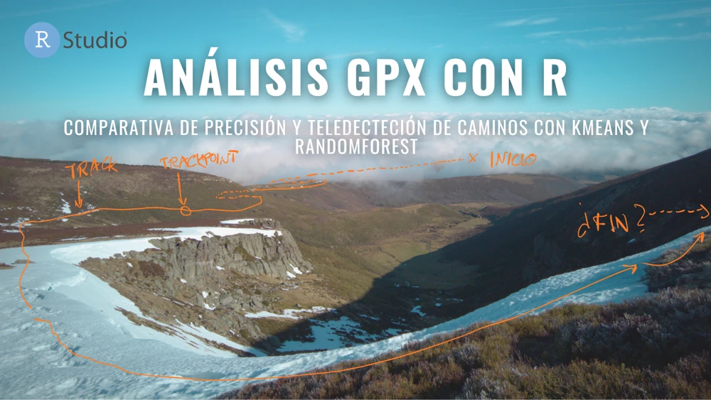
¿GPX Móvil o Pulsera? Un paseo, dos registros, random forest y R
¿Qué método de registro gps es mejor, un móvil o una pulsera de actividad? Con esta motivación parte este artículo. Se ha la misma ruta pero con dos dispositivos distintos y después se ha utilizado R para analizar esos archivo .gpx. Después, ya con el pique, se han comparado los registros de los tracks con los caminos disponibles en OpenStreetMaps. Por último, se ha probado a digitalizar de forma semiautomática los caminos a través de una ortofoto, logrando algunos resultados interesante con un esfuerzo mínimo. El resultado te sorprenderá.
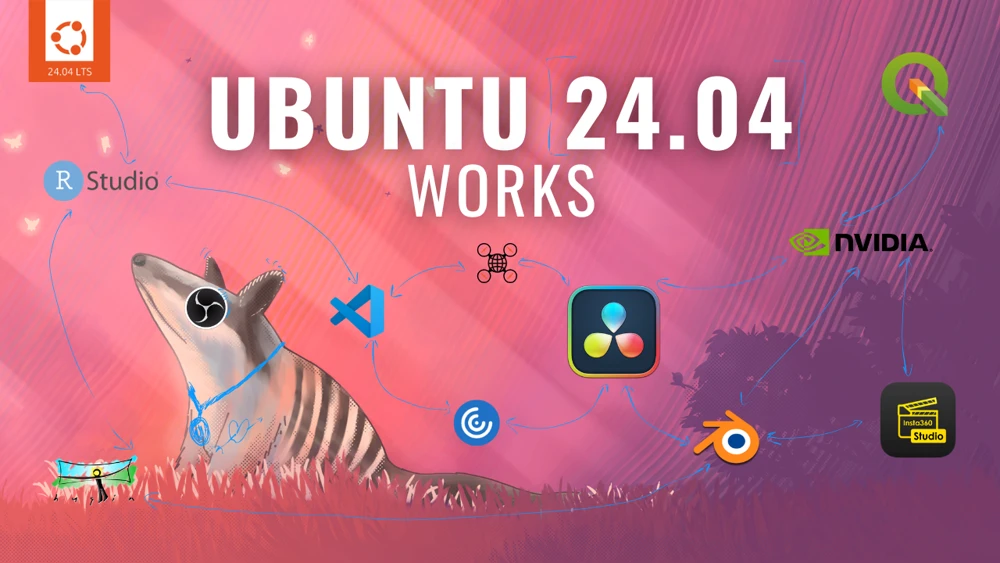
Ubuntu 24.04 works: QGIS, Davinci, OpenDroneMap, Blender y más
Después de al menos 4 años usando Ubuntu 22.04, con idas y venidas, configuraciones y desconfiguraciones, he decidido dar el salto y actualizar el sistema a la última versión de Ubuntu lts, la 24.04. Sabía que todo se iría al carajo, como cada vez. Sin embargo, es posible dejarlo tan listo que no solo funcione igual, si no mejor. En esta entrada mi objetivo es uno y muchos. Uno, tener un sistema funcional para trabajar. Muchos: entorno QGIS, entorno Blender, servidor R Server, servidor Shiny, editor de colecciones masivas de fotografías, editor funcional con Davinci Resolve, etc.
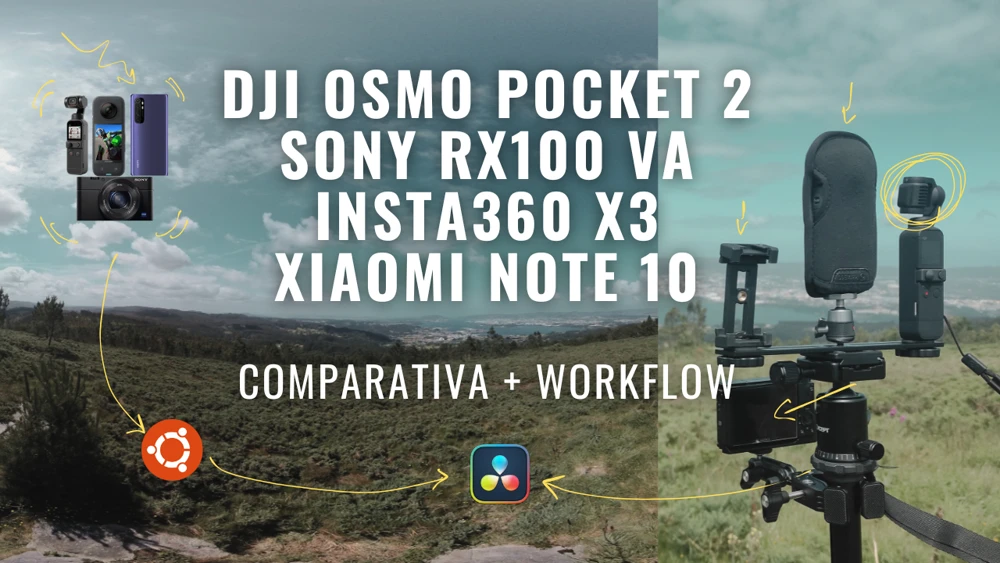
DJI Osmo Pocket 2 vs Sony RX100VA vs Insta360X3 vs Xiaomi Note 10
Esta entrada de blog está dedicada a todos aquellos frikis de las reviews (comparativas entre cámaras de toda la vida). La velocidad de lanzamiento de nuevos módelos hace imposible estar a la última (a no ser que seas uno de esos influencers que tiene la gracia de recibir los modelos en su casa para hablar de ellos). Sin embargo, a veces, es bueno parar, ver lo que tienes en el equipo, conformarte, y exprimirlo al máximo. La idea de esta entrada con vídeo surge a partir del lanzamiento este año de la DJI Osmo Pocket 3, una cámara con gimbal incorporado y con un appeal de la hostia. Pero espera, ¿que tal era la DJI Osmo Pocket 2? ¿ya no vale ni un pimiento? Pues que valiendo la mitad que su hija, puede darte mucho juego. Aquí te enseño algunos detalles.
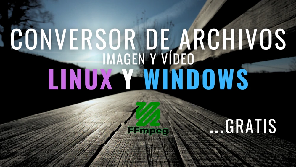
Conversor de archivos de imagen y vídeo gratis en Linux y Windows
Si eres uno de esos que aprendió algo de libros como “la semana de 4 horas” y “hábitos atómicos”, sabrás que el batching o dosificación de tareas es algo realmente práctico para dar salida a todos esos temas recurrentes.
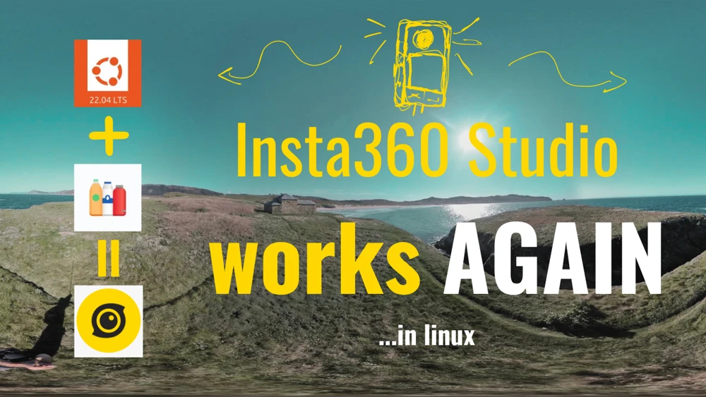
Insta360 Studio Works...en linux
Tras varios meses en el dique seco respecto a la edición de fotos y vídeos 360 directamente en Linux, ha llegado el momento de volverlo a intentar. Sorpresa: la nueva actualización de Insta360 Studio 5.1 funciona en Bottles configurado con Wine. Sorpresón de hecho, porque no solo funciona, sino que lo hace ahora más rápido de lo que lo haría una renderización de imágenes en una máquina virtual de Windows 11.
Paisaje y Energía en Blender - Los tutoriales completos
Blender vale casi para tantas cosas que no tiene sentido hacer una lista. Es más fácil decir que puede ser utilizado para hacerlo todo (incluso planchar la ropa). Esta es la primera entrada de una serie de 5 capítulos en los que muestro todo sobre Blender para poder levantar posiciones reales en 3D e integrar en ellas (en foto o en vídeo) elementos de energía renovable. Esto será solo para abrir boca, porque hay mucho por llegar.
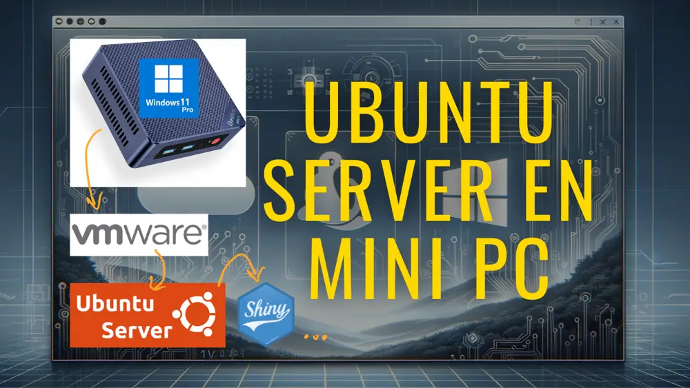
VMware y Shiny Server: Mini PC Ubuntu Server para casa
¿Quieres montar tu propio servidor, bueno, bonito y barato? ¿Quieres que además este te sirva como R Studio accesible desde cualquier lugar y que además de permita desplegar Shiny apps? Este es tu post.
Blender 360 City - De BlenderGIS a Video 360
📅 08 Jun 2025 | César Arquero Cabral | Img-Video-3D-Blender
Insta360 X5 - Review y cambios respecto a la X3
📅 15 May 2025 | César Arquero Cabral | Img-Video-3D-Blender
Productos de dron en Linux - OpenDroneMap - Tutorial avanzado
📅 15 Apr 2025 | César Arquero Cabral | Img-Video-3D-Blender
Fotogrametría y Cartografía en Linux - Meshroom y los modelos 3D Mesh
📅 15 Mar 2025 | César Arquero Cabral | Img-Video-3D-Blender
Make + ChatGPT: La automatización de cualquier cosa
📅 15 Feb 2025 | César Arquero Cabral | R-Shiny-Data Science
¿GPX Móvil o Pulsera? Un paseo, dos registros, random forest y R
📅 15 Jan 2025 | César Arquero Cabral | R-Shiny-Data Science
Ubuntu 24.04 works: QGIS, Davinci, OpenDroneMap, Blender y más
📅 07 Dec 2024 | César Arquero Cabral | Img-Video-3D-Blender
DJI Osmo Pocket 2 vs Sony RX100VA vs Insta360X3 vs Xiaomi Note 10
📅 27 Oct 2024 | César Arquero Cabral | Img-Video-3D-Blender
Conversor de archivos de imagen y vídeo gratis en Linux y Windows
📅 26 Sep 2024 | César Arquero Cabral | Img-Video-3D-Blender
Insta360 Studio Works...en linux
📅 22 Apr 2024 | César Arquero Cabral | Img-Video-3D-Blender
Paisaje y Energía en Blender - Los tutoriales completos
📅 18 Apr 2024 | César Arquero Cabral | Img-Video-3D-Blender
VMware y Shiny Server: Mini PC Ubuntu Server para casa
📅 19 Feb 2024 | César Arquero Cabral | R-Shiny-Data Science
Estadísticas en raster y vectores grandes + Imágenes de ChatGPT
📅 12 Feb 2024 | César Arquero Cabral | R-Shiny-Data Science
Blender VSE: Edición, Composición y Tracking para Principiantes
📅 29 Nov 2023 | César Arquero Cabral | Img-Video-3D-Blender
Cómo estabilizar vídeos gratis, rápido y fácilmente para stock
📅 14 Nov 2023 | César Arquero Cabral | Img-Video-3D-Blender
Renderizar una plantación de eucaliptos - Animación y geometry nodes
📅 31 Oct 2023 | César Arquero Cabral | Img-Video-3D-Blender
Render 360 landscape in 12 K. Blender tutorial for 360 World
📅 25 Sep 2023 | César Arquero Cabral | Img-Video-3D-Blender
Creating immersive 360-degree worlds and landscapes in Blender
📅 15 Sep 2023 | César Arquero Cabral | Img-Video-3D-Blender
Drones, Denoising and Blender. Stock video with DJI Mini 2
📅 07 Aug 2023 | César Arquero Cabral | Resources-Tools
Detalied Terrains with Blender and Google Satellite
📅 01 Aug 2023 | César Arquero Cabral | Img-Video-3D-Blender
360 Photography and Sun Position: Lessons from Ortigueira
📅 25 Jul 2023 | César Arquero Cabral | Img-Video-3D-Blender
Visibilidad Eólica en Galicia - Parte II
📅 17 Jul 2023 | César Arquero Cabral | R-Shiny-Data Science
Visibilidad Eólica en Galicia - Parte I
📅 21 Jun 2023 | César Arquero Cabral | R-Shiny-Data Science
Tablet shortcuts for Blender. Huion HS611 in linux
📅 03 May 2023 | César Arquero Cabral | Resources-Tools
Realistic Solar Power Plant and Blender Motion Tracking
📅 27 Apr 2023 | César Arquero Cabral | Img-Video-3D-Blender
Creating Dynamic Wind Turbines with Blender
📅 19 Apr 2023 | César Arquero Cabral | Img-Video-3D-Blender
Terrain Mapping benchmark with OpenDroneMap
📅 01 Apr 2023 | César Arquero Cabral | Img-Video-3D-Blender
Insta360-X2 vs Ricoh Theta X - E04 - Prueba nocturna
📅 15 Feb 2023 | César Arquero Cabral | Img-Video-3D-Blender
Lectura y procesamiento de datos .nc con R
📅 01 Feb 2023 | César Arquero Cabral | R-Shiny-Data Science
Experimento de tiempos de desplazamiento
📅 26 Jan 2023 | César Arquero Cabral | GIS-Mapping
Insta360-X2 vs Ricoh Theta X - E03
📅 18 Jan 2023 | César Arquero Cabral | Img-Video-3D-Blender
Guía de Uso del Potencial Eólico (NEWA)
📅 04 Jan 2023 | César Arquero Cabral | Resources-Tools
Insta360-X2 vs Ricoh Theta X - E02
📅 14 Dec 2022 | César Arquero Cabral | Img-Video-3D-Blender
Insta360-X2 vs Ricoh Theta X - E01
📅 01 Dec 2022 | César Arquero Cabral | Img-Video-3D-Blender
Splitting a Polygon into Quadrants
📅 23 Sep 2022 | César Arquero Cabral | R-Shiny-Data Science
A Living List of Inspirational Sources for Our Work
📅 06 Sep 2022 | César Arquero Cabral | Resources-Tools
Finding the Shortest Path using the Tobler Function
📅 20 Jul 2022 | César Arquero Cabral | R-Shiny-Data Science
Solutions GIS Stack Exchange Problems
📅 07 Jun 2022 | César Arquero Cabral | R-Shiny-Data Science
360 Image Rendering
📅 07 Jun 2022 | César Arquero Cabral | Img-Video-3D-Blender
Least Squares in Raster grid (es)
📅 28 Mar 2022 | César Arquero Cabral | R-Shiny-Data Science
Zonificación Ambiental Energías Renovables, WMS y R parallel
📅 26 Mar 2022 | César Arquero Cabral | R-Shiny-Data Science
Coordinates to GIS with R
📅 24 Jan 2022 | César Arquero Cabral | R-Shiny-Data Science
Largest Visible Area
📅 12 Jan 2022 | César Arquero Cabral | GIS-Mapping
Sony RX100 VA + Zhiyun Crane M2 + Blender - 1ª parte (es)
📅 14 Jul 2021 | César Arquero Cabral | Img-Video-3D-Blender
Análsis de texto automatizado para captura de lugares en libros
📅 09 Jul 2021 | César Arquero Cabral | R-Shiny-Data Science
Polígonos parcelarios en R. Solución GIS Stackexchange
📅 26 Feb 2021 | César Arquero Cabral | R-Shiny-Data Science
Extraer valores raster por polígonos, líneas y puntos
📅 17 Feb 2021 | César Arquero Cabral | R-Shiny-Data Science
Blender: Timelapse of a Timelapse
📅 04 Feb 2021 | César Arquero Cabral | Img-Video-3D-Blender
landtools - (en desarrollo)
📅 03 Feb 2021 | César Arquero Cabral | R-Shiny-Data Science
PBADownloader - Herramienta de descarga masiva de catastro
📅 01 Feb 2021 | César Arquero Cabral | R-Shiny-Data Science
RproWIND - (en desarrollo)
📅 31 Jan 2021 | César Arquero Cabral | R-Shiny-Data Science
CatastroDownloader (es)
📅 28 Jan 2021 | César Arquero Cabral | R-Shiny-Data Science
Seleccionar directorios en R (a mano)
📅 18 Jan 2021 | César Arquero Cabral | R-Shiny-Data Science
IterativeSteinerTree
📅 17 Jan 2021 | César Arquero Cabral | R-Shiny-Data Science