Siguiendo la secuencia de trabajo presentada en el anterior post relativo a la compartiva sistemática entre las cámaras...

Estudios de paisaje, cartografía (R y QGIS), diseño ambiental 3D (Blender) y análisis de datos geográficos en R
Estudios de paisaje, cartografía (R y QGIS), diseño ambiental 3D (Blender) y análisis de datos geográficos en R
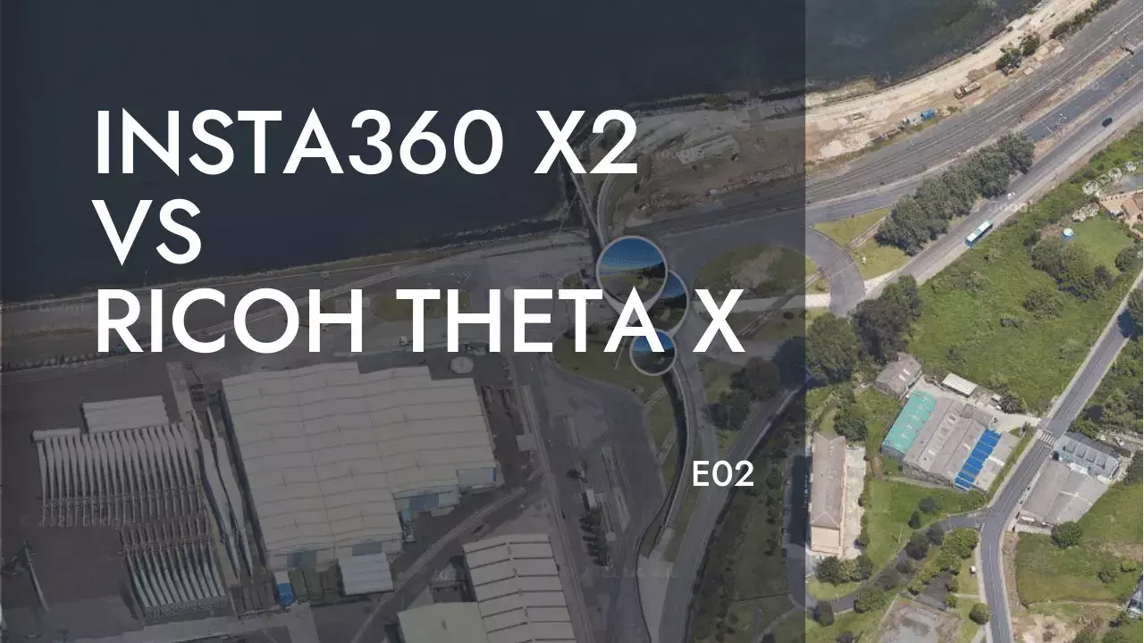
Siguiendo la secuencia de trabajo presentada en el anterior post relativo a la compartiva sistemática entre las cámaras...
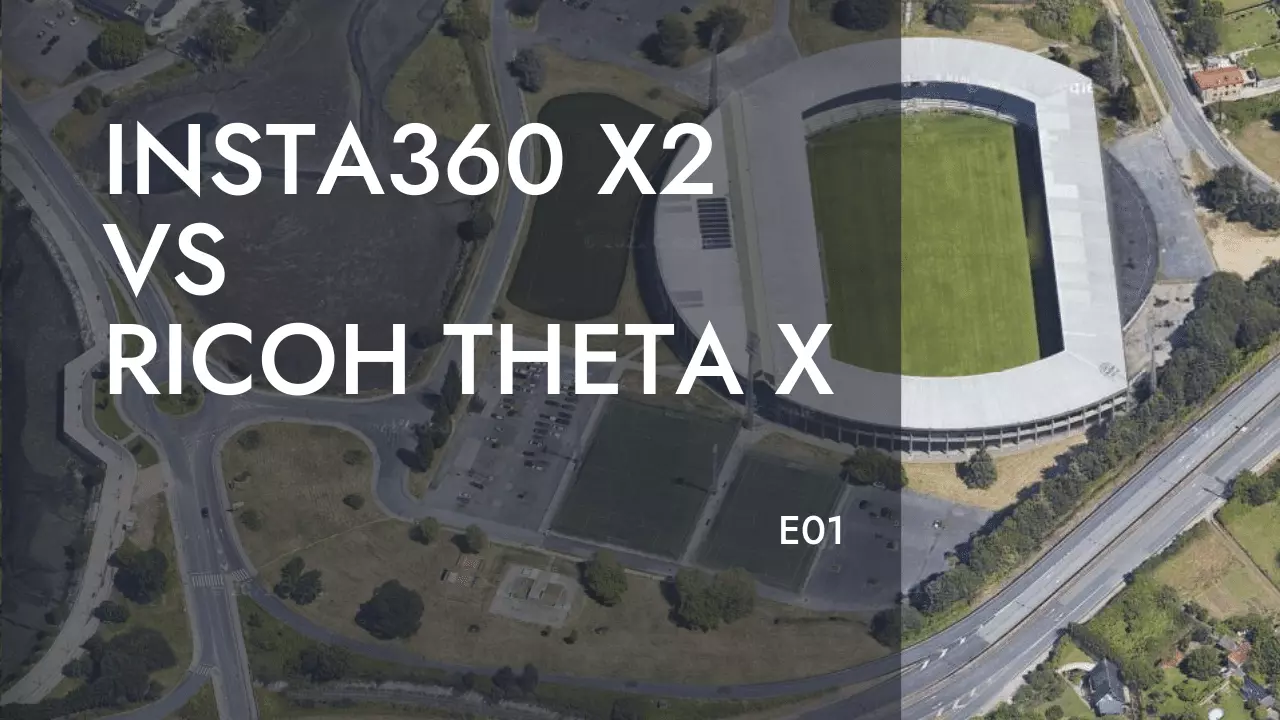
Esta entrada del blog tiene por objeto establecer una comparativa, relativamente sistemática, entre dos cámaras 360 de uso...
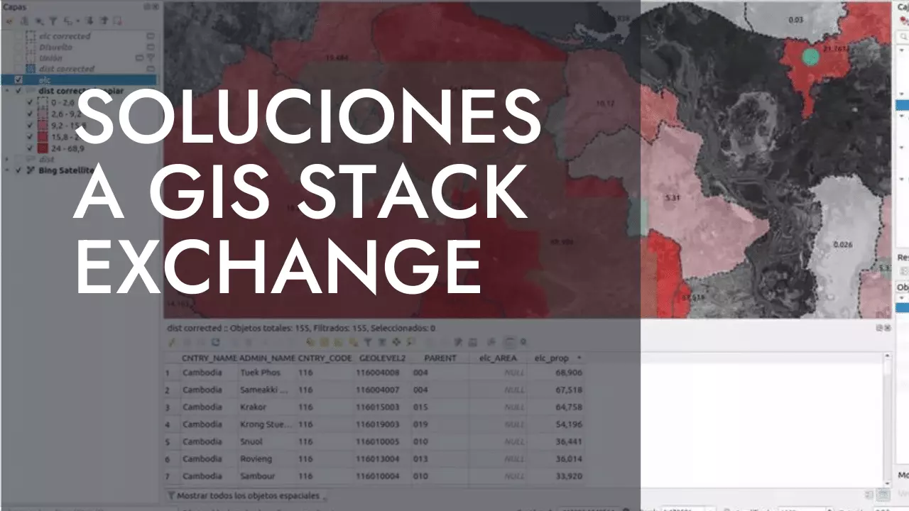
This is the QUESTION IN GIS STACK EXCHANGE that it is not totally solved in our favorite forum....

This is not just a list, this is much more. These people here are the best of the...
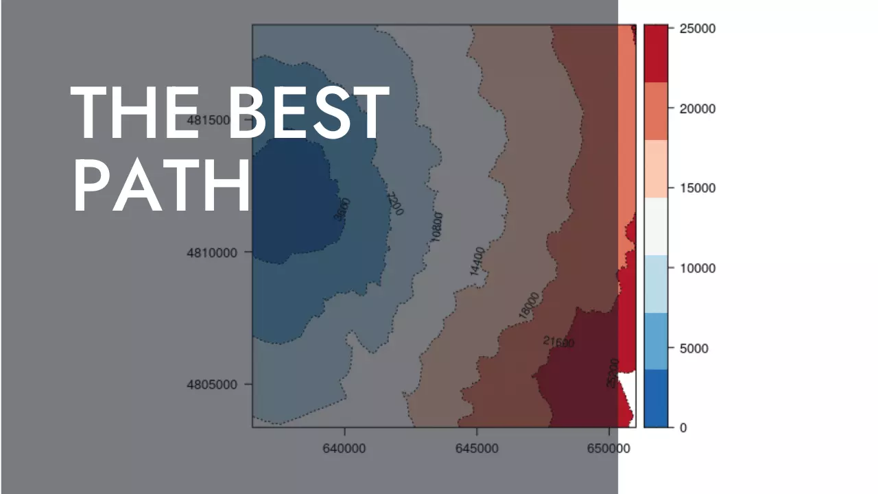
The following post was made trying to understand the functions withing the gdistance R package by Jacob van...
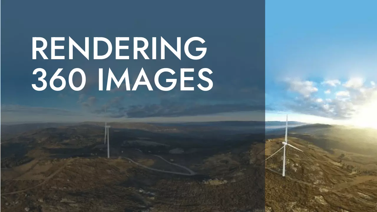
If you don’t want to rely on external servers you can serve it directly creating a 3D with...
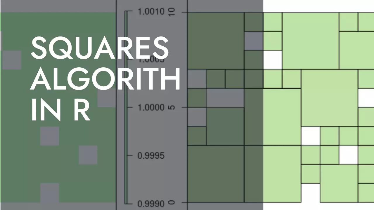
En este caso, alguien busca como encajar cuadros de diversos tamaños en un raster grid (sus motivos tendrá),...
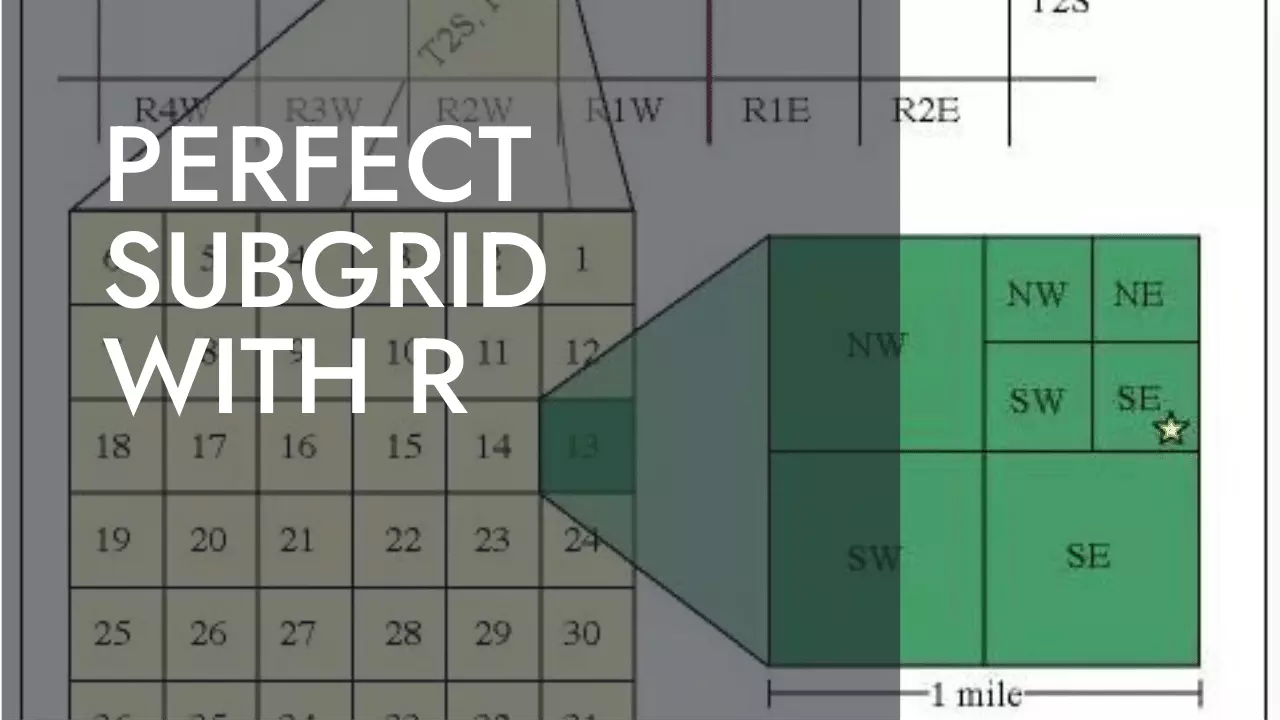
Este post está destinado a aquellos que, como en mi caso, os hayais dado de bruces intentando replicar...
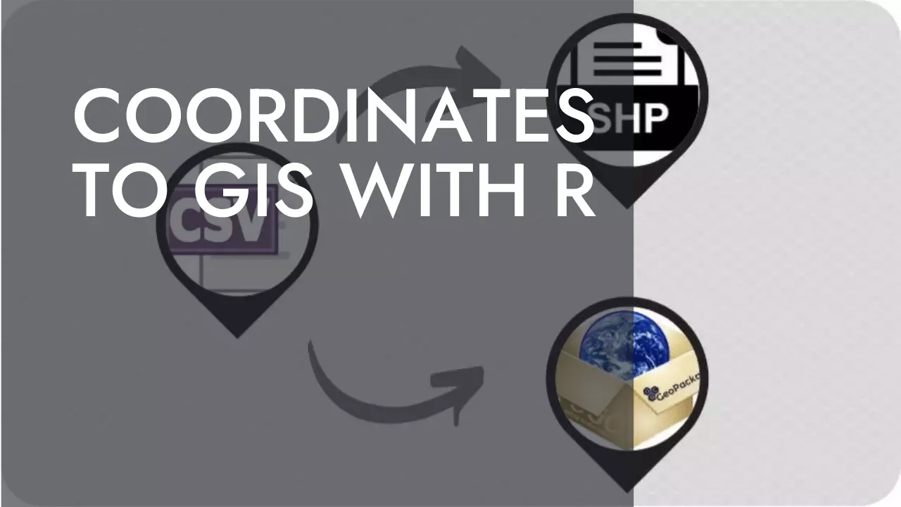
En muchos casos, una capa de puntos viene dada en forma de excel o archivo .csv donde 2...
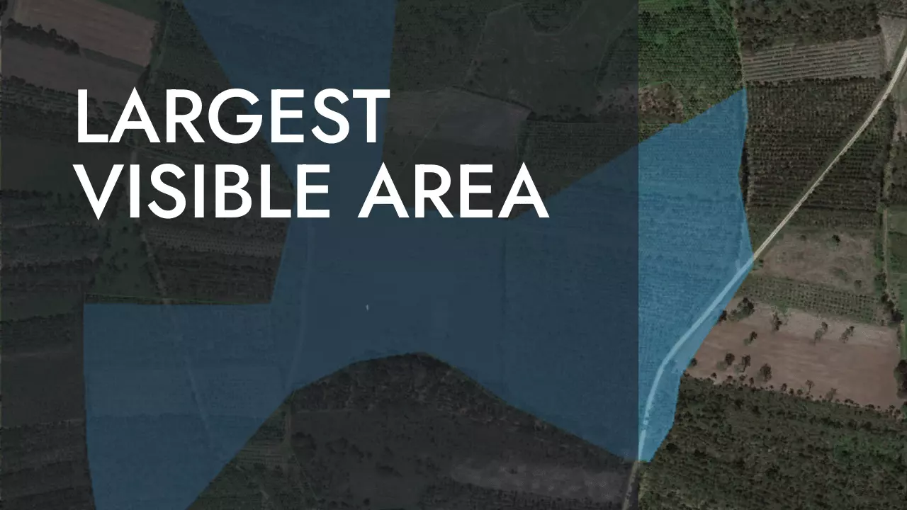
El siguiente poceso sirve para identificar la posición en la que el área visible a su alrededor es...