
Estudios de paisaje, cartografía (R y QGIS), diseño ambiental 3D (Blender) y análisis de datos geográficos en R
Estudios de paisaje, cartografía (R y QGIS), diseño ambiental 3D (Blender) y análisis de datos geográficos en R
Estudios de paisaje, cartografía (R y QGIS), diseño ambiental 3D (Blender) y análisis de datos geográficos en R
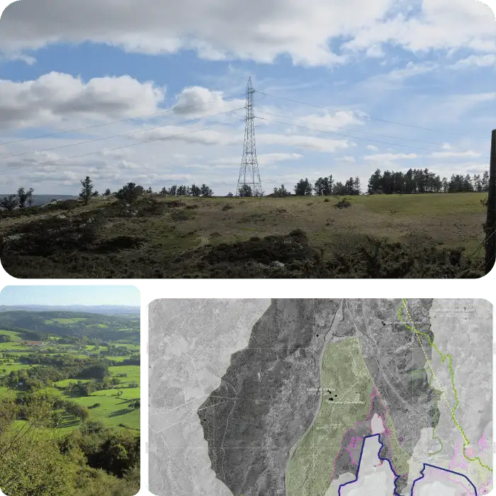
Plan your renewable energy project with our expert environmental consulting services. Our team specializes in conducting EIAs and providing guidance on visual impact studies and landscape analyses. Our LVIA services offer comprehensive solutions for project planning and environmental impact assessment, helping you make informed decisions about your project's location and potential impact.
Get expert help planning your renewable energy project. Our experienced team specializes in conducting EIAs, providing guidance on visual impact studies and landscape analyses, and answering key questions about your project's potential impact. With our LVIA services, we offer a technical procedure for deciding on locations and solutions, ensuring you make informed decisions about your project's location and potential impact.
Ensure your renewable energy project is sustainable and visually appealing. Contact us for expert guidance on visual impact studies and landscape analyses with our LVIA services. Make informed decisions about your project's location and potential impact with our help.
Contact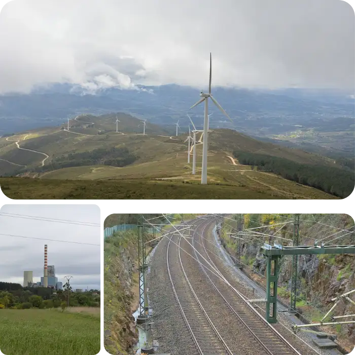
As our society becomes more conscious of the need for environmental responsibility, it's crucial to take into account the impact of any project on the environment. It's essential to address questions such as how a project can be designed to be more eco-friendly, what alternatives it can offer, and what environmental and socioeconomic implications it may have on the territory. This is where an Environmental Impact Study (EIS) can play a crucial role.
Our team specializes in conducting EIAs and LVIA's for renewable energy projects, including associated infrastructures such as energy production, high voltage networks, highways, railways, and more. We can help you make a comprehensive analysis of the environmental impact of your project, with specific training in the tools for carrying out environmental studies. With our guidance, you can ensure that your project is environmentally responsible and sustainable.
Don't leave the impact of your project on the environment to chance. Contact us to learn more about our expert advice for Environmental Impact Studies and analysis of environmental data. With our help, you can make informed decisions about your project and its impact on the environment and surrounding territory.
Contact
Are you facing a complex geographic analysis project, such as determining the most likely place to find a species, performing a massive viewshed analysis with millions of observation points, or understanding the temporal evolution of vegetation cover? Perhaps you need a modeling of geographic processes, and the task seems impossible. Fortunately, we're here to help.
Our team of experts can help you not only decide the goal of your project but also achieve it accurately and systematically. With our specialized knowledge and advanced tools, we can guide you through complex geographic analyses and help you make informed decisions about your project. Additionally, we can assist with the design and printing of cartography, large-scale maps, and 3D topographic printing, ensuring you have the necessary materials to understand and communicate your findings effectively.Don't let a challenging geographic analysis project overwhelm you. Contact us to learn more about our services and how we can help you achieve your project goals. With our expertise and support, you can navigate complex analyses with ease and confidence, and make informed decisions that will benefit both your project and the environment.
Contact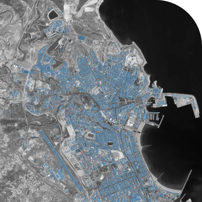
Geographic data is crucial for a wide range of projects, whether you need information on buildings, forests, or species. However, obtaining this data can be a challenging and time-consuming task. At our company, we specialize in collecting and organizing geographic data, helping you to access the information you need for your project. From fieldwork to data capture and analysis, we have the expertise and tools to provide customized solutions to meet your needs.
Our team of experts can help you to identify and obtain the geographic data you require, regardless of whether it is provided by government agencies, organizations, or private institutions. We can also conduct fieldwork to collect the necessary data for you, traveling across the country to gather valuable information on buildings, natural resources, and other features. We can help you to determine how the data is distributed in time and space, providing insights into the patterns and trends that are relevant to your project.
If you need geographic data for your project, don't hesitate to contact us. Our team of experienced professionals is ready to provide customized solutions to meet your needs. We can help you to capture and organize data, or simply provide the tools and guidance you need to do it yourself. With our help, you can access the geographic data you need to make informed decisions and drive the success of your project.
Contact