
Estudios de paisaje, cartografía (R y QGIS), diseño ambiental 3D (Blender) y análisis de datos geográficos en R
Estudios de paisaje, cartografía (R y QGIS), diseño ambiental 3D (Blender) y análisis de datos geográficos en R
Estudios de paisaje, cartografía (R y QGIS), diseño ambiental 3D (Blender) y análisis de datos geográficos en R
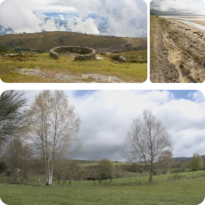
Are you looking for high-quality, accurate photographs to showcase your project? Our team uses state-of-the-art technology and tools to capture stunning images and videos that accurately represent your vision. Whether it's for personal or construction purposes, we'll work with you to get the best possible representation of your project, using the landscape elements present.
Not only do we provide exceptional photography services, but we also offer design services for environmental documents, project albums, photo tours, 360 tours, and other online image viewing tools. Our goal is to provide a comprehensive solution for your visual needs, from capturing the perfect shot to presenting it in the most effective way possible.
Don't settle for mediocre photography. Trust our team to provide you with the best possible representation of your project, using cutting-edge technology and expert techniques. Contact us today to learn more about our photography and design services.
Contact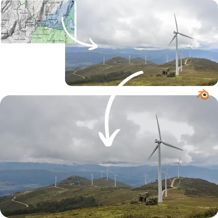
Would you need to see and be able to show how a project would look once done? We work on the precise representation of the projects, using the best editing techniques on image and video.
We provide professional rendering and visualization services for your project using top-notch image and video editing techniques, allowing you to see the finished result before it's even started. Our team specializes in creating photorealistic representations of renewable energy projects and associated infrastructures with precision, utilizing topographic modeling and 3D environmental modeling with geographic information. Our services are not limited to renewable energy projects, and we welcome all kinds of projects and unique proposals. Contact us today to bring your project to life with our expert services.
With our professional rendering and visualization services, you can have a precise representation of your project that will help you make informed decisions about its development. Contact us now to get started.
Contact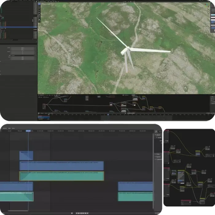
Are you looking to bring your project to life in 3D? Whether it's an object, a landscape element, or a building, we can create a high-resolution 3D model for you. Our team of experts can transform your paper plans into a tangible, realistic representation of your project that you can visualize and share with others.
But our services don't stop there. We also provide layers and HDRI images, allowing you to do your own rendering. By capturing images from the real location, we can provide you with a range of weather and lighting conditions to choose from. And if you need video of a location, we can capture and layout the footage for you.
Let us bring your project to life with our professional 3D modeling, HDRI imaging, and video editing services. Contact us today to learn more and get started.
Contact