In this tutorial, we’ll guide you through the process of creating a lifelike rendering of solar renewables power...

Estudios de paisaje, cartografía (R y QGIS), diseño ambiental 3D (Blender) y análisis de datos geográficos en R
Estudios de paisaje, cartografía (R y QGIS), diseño ambiental 3D (Blender) y análisis de datos geográficos en R
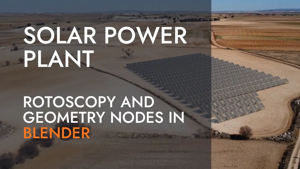
In this tutorial, we’ll guide you through the process of creating a lifelike rendering of solar renewables power...
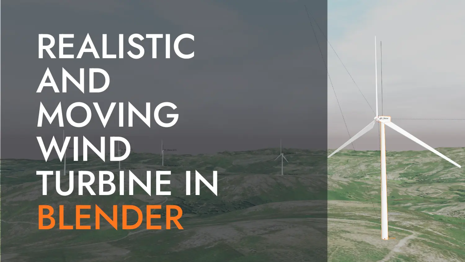
The objective of this video is to render a digital terrain model along with dynamic wind turbines. The...
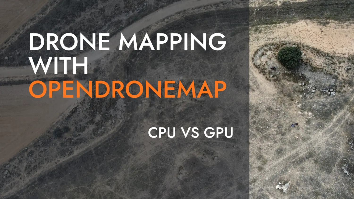
If you have an interest in drone mapping and terrain analysis, you’ll want to check out this exercise...